Health & Fitness
Major landscaping project re-shaping Nature Reserve scenic site
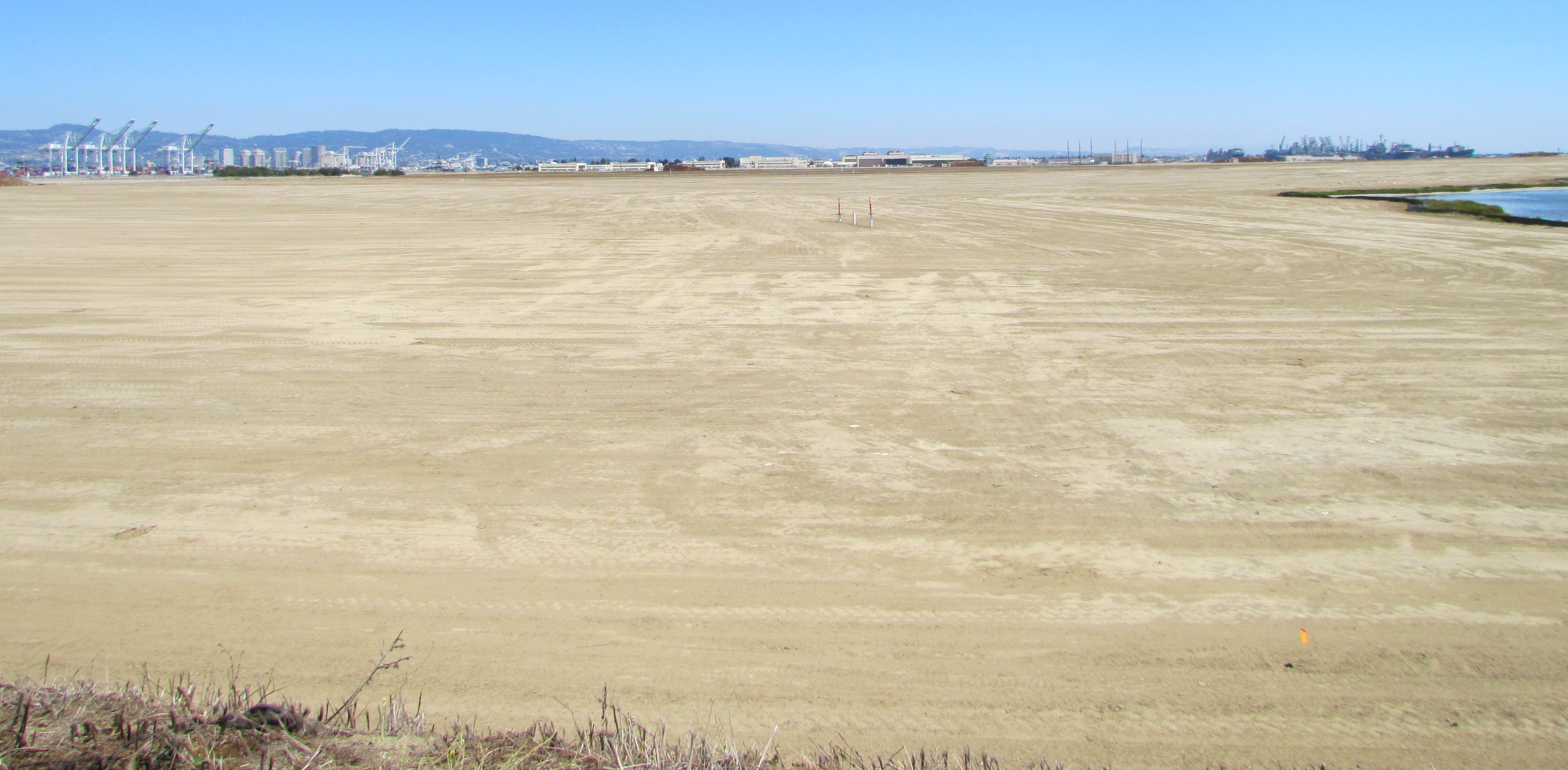


The old waste disposal area on Alameda Point’s southwest corner is finally receiving a proper soil cover. Nearly 500,000 cubic yards of clean soil from Decker Island is being imported. This fall the Navy will seed the soil cover with 13 different California native grasses, most of which are flowering. In addition, 30 acres of wetlands are being improved.
A portion of the nearby western shoreline has already been designated as a public access area. It will be accessible via the road that the U.S. Department of Veterans Affairs (VA) will build alongside their clinic and columbarium property. The Bay Trail will pass by the area. A regional park is designated for the area to the north that runs along the Oakland Estuary.
The site was once used to dispose of the Navy’s industrial waste. It was closed and covered with soil in the mid-1980s, but the cover never met modern standards for landfill closure. Following closure of the naval air station in 1997, the site was added to the Superfund cleanup program. After more than a decade of review, a plan is now being implemented.
Find out what's happening in Alamedawith free, real-time updates from Patch.
Early concerns about toxic chemicals leaching into the Bay have been allayed through years of groundwater monitoring. Recent tests show that the various waste pits, which are sitting in water-saturated soil, are not releasing chemicals into groundwater. Chemical concentrations in water are below the risk level and are either stable or declining. The area has been scanned for radiological contamination on several occasions and will again be scanned before the final two feet of soil is put in place. Various objects and soil areas contaminated with radium paint waste have been removed.
During the August 3, 2013 Navy-led environmental cleanup tour, the soil cover’s base layer was nearing completion. The Navy has already reused over 100,000 cubic yards of dredging soil from the Seaplane Lagoon that tested clean. The soil being importing by barge is coming from Decker Island in the Sacramento River near the town of Rio Vista.
Find out what's happening in Alamedawith free, real-time updates from Patch.
Plans for public access to the area will be developed once the VA takes ownership of the area. The barbed wire security fence originally proposed around the site has been removed from plans. Unsightly methane gas vents that were originally 10 feet tall have been cut down to two feet, since the site produces only a miniscule amount of methane. A portion of the nearby western shoreline has already been designated as a public access area. It will be accessible via the road that the VA will build alongside their clinic and columbarium property.
Google map showing location of the site is here.
More photos and info are on the Alameda Point Environmental Report.


